
The Street Patio Program offers four patio configurations depending on your needs and context of...
Thank you to everyone who was able to attend last weeks Ontario and Market Street traffic study presentation by the City of Kingston. It was an informative meeting. The Downtown Kingston BIA and the Community Spaces Advisory Working Group will continue to be involved as this project moves forward.
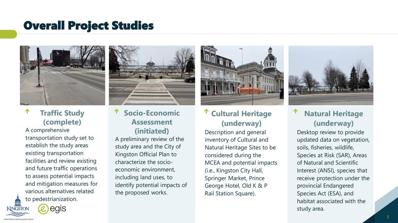
The image above is from the presentation, outlining the studies that will be done for this project. For those that were unable to attend, click on the link below to review the transportation study as well as the presentation from last week.
Below is more information from the transportation department at the City of Kingston who are spearheading the study process that provide further clarification about some questions that came up at the presentation.
Q. Was traffic data from the summer seasons used when tourists are there? If not, how did the transportation modeling account for that?
R. The Traffic Study only summarizes the ‘most recent’ traffic data that was used in developing the existing study area traffic volumes. However, historic traffic counts were also provided and reviewed, including summer months (May to September) of 2011, 2014 and 2018, which reflect peak summer conditions.
It is important to note, traffic volumes are generally consistent throughout the year. A defined seasonal peak in traffic volume is not reflected in the historic data, however an increase pedestrian movement is noted. This is consistent City wide, even in the downtown area; a decline in commuter traffic is typically observed in the summer months which likely offsets the additional volume experienced from tourism – this has been confirmed in previous observations as well. It should also be noted that the use of historical traffic volumes to project current and future volumes in this area was not suggested due to the fact that traffic patterns have changed since the pandemic and this area has seen additional traffic volume reductions due to the opening of the Waaban Crossing.
Q. What does the design of these alternatives look like?
R. The design and layout of the alternatives is still to be determined. The current stage of the study is to determine feasibility, once the project direction has been defined, design work can begin to identify what the potential alternatives might look like. It is noted that the pedestrianization of Ontario St. and Market St. would provide opportunity to reimagine the streetscape.
Q. What would the City do if issues arise in other areas that are expected or unexpected?
R. The Transportation Study includes recommendations for mitigating strategies that maybe required in the future horizon (2033), as increased volumes are experienced from development and growth. The City is aware of these conditions and would continue to monitor the transportation network and collect data to inform the need for future improvements.
Q. What are the next steps?
R. The next steps are generally summarized as follows:
- Finalize Supporting Studies (preliminary Socio-Economic, Cultural Heritage and Natural Heritage)
Timeline: end of April 2024
The preliminary Socio-Economic study will be used to inform the initiation of the Detailed Economic Study. - Initiate Detailed Economic Study
Timeline: May 2024 - Ongoing Stakeholder Consultations
Timeline:Summer 2024 - Space Renderings – (based on direction of project following the above)
Timeline: Summer 2024
The Renderings noted above will provide the look and feel of the proposed alternative. - Public and Stakeholder Consultation (PIC)
Timeline: Fall 2024 - Final Report/ Recommendation
Timeline: Q4 2024
Q. Where will the information be placed?
R. Information will be made available on the projects Get Involved page (link below) – look under the ‘Documents’ tab.